Maps
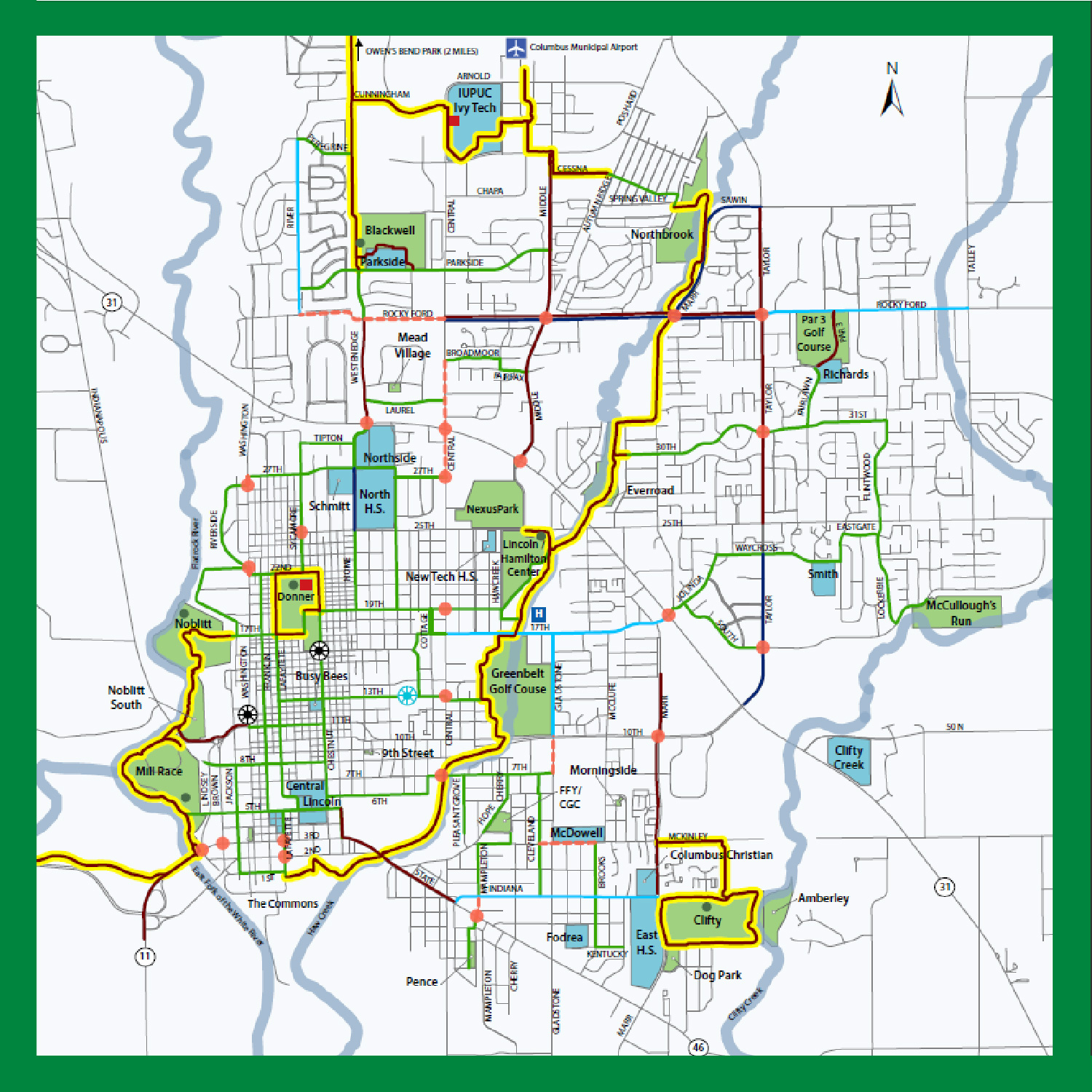
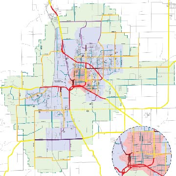
People Trail Map / Columbus Bike Map (Updated 2022)
The map to the right is a map of existing shared use paths, bicycle lanes, neighborhood bicycle routes, and other suggested routes throughout the City of Columbus. The map also features the Columbus People Trail Network. This map was most recently updated in 2022 and is an update to the 2018 Columbus by Bike Map, which was created in partnership between Columbus Regional Health/Healthy Communities, the City of Columbus-Bartholomew County Planning Department, Columbus Parks and Recreation, the Columbus Park Foundation, the Columbus Visitor’s Center, the Bicycle Co-op, and the Bicycle Station.
To view a PDF or to print this map, click the photo to the right.
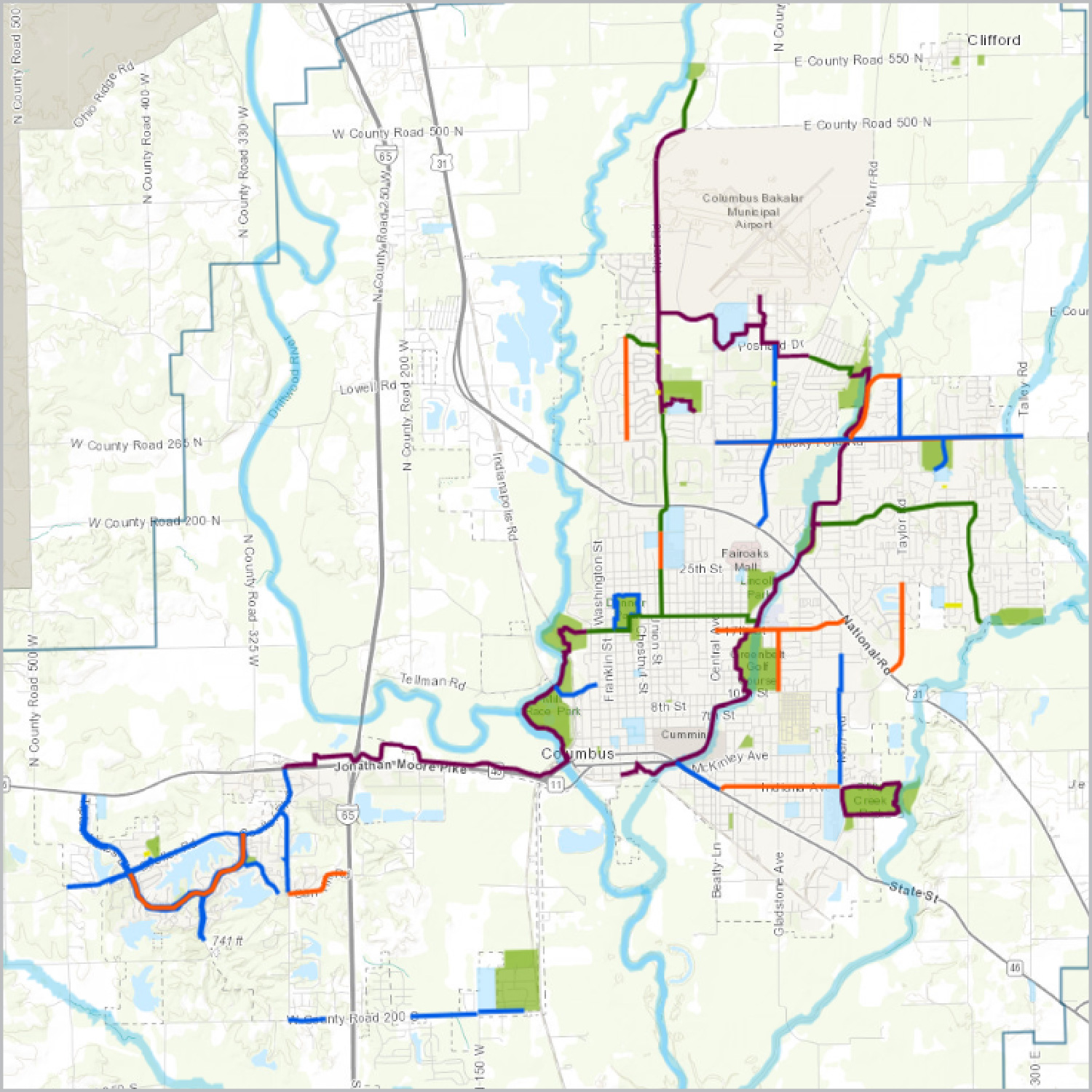
Existing Bicycle and Pedestrian Facilities Map (Interactive)
With the City of Columbus Bicycle and Pedestrian Plan and the City of Columbus Thoroughfare Plan as guides, the City is continually working to improve and expand the city’s network of trails, sidewalks, and other bicycle and pedestrian facilities.
The photo to the right is a link to an online, current map of all existing facilities, excluding sidewalks, in the City. This map will continue to be updated as new share use paths, bicycle lanes, and other facilities are constructed.
Bicycle Parking Spaces (Interactive)
Knowing where or if you’ll be able to securely lock up your bicycle at a destination is a common concern for bicyclists. This interactive map is intended to alleviate some of that concern.
The photo to the right is a link to an online map that shows the location of bicycle racks in our community. The map also indicates the type of bicycle rack you’ll find at each location.
Columbus Comprehensive Plan
City of Columbus Bicycle and Pedestrian Plan (2022)
The City’s Bicycle and Pedestrian Plan establishes a roadmap for creating a system of bicycle and pedestrian facilities that connect people to local destinations. Goals outlined in the Plan include (1) increasing opportunities for bicyclists and pedestrians to efficiently commute and recreate by connecting parks, schools, transit, shopping and employment centers, and other key destinations; (2) removing gaps in the sidewalk network; (3) establishing a bicycle and pedestrian network that is safe and comfortable for users of all ages and abilities; and (4) implementing an intuitive and comprehensive wayfinding system for bicyclists and pedestrians. This Bicycle and Pedestrian Plan was adopted as an element of the City of Columbus Comprehensive Plan in April 2022 and serves as an update and replacement to the City’s previous Bicycle and Pedestrian Plan, which was adopted in 2010.
View the City of Columbus Bicycle and Pedestrian Plan by clicking the photo to the right.
City of Columbus Thoroughfare Plan (2010)
The City’s Thoroughfare Plan contains policies and standards for new and reconstructed streets within Columbus and Columbus’ Two-Mile Extraterritorial Planning Jurisdiction. The Thoroughfare Plan is a guide that anticipates future transportation needs and aims to maintain a well-connected, efficient, and effective street network. The Thoroughfare Plan is a complete streets policy, which means that it recommends street design that enables safe access for all users, including pedestrians, bicyclists, transit users, and motorists. The Thoroughfare Plan was adopted as an element of the City of Columbus Comprehensive Plan in November 2010.
View the City of Columbus Thoroughfare Plan by clicking the photo to the right.
Studies
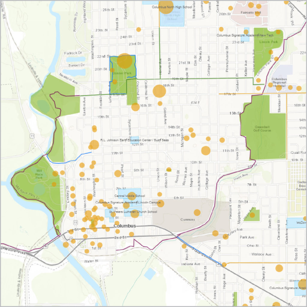
Bartholomew Consolidated School Corporation Safe Routes to School Plan (2012)
The BCSC Safe Routes to School Plan was completed in 2012 through the efforts of the Bartholomew County Safe Routes to School Committee, which consisted of representatives from several City departments, BCSC, and CRH Healthy Communities. The Committee worked with consultants, Alta Planning & Design and Burgess & Niple, to create this Plan for nine schools (CSA Lincoln, Parkside, Richards, Schmitt, Smith, Southside, & Taylorsville Elementary Schools and Central & Northside Middle Schools). The plan identifies areas around each school that need intersection improvements, sidewalk repair, bicycle parking, enhanced lighting, and/or traffic control and provides recommendations for improvements. The plan also includes various educational programs and incentives to support walking and biking to school.
View the BCSC Safe Routes to School Plan by clicking the photo to the right.
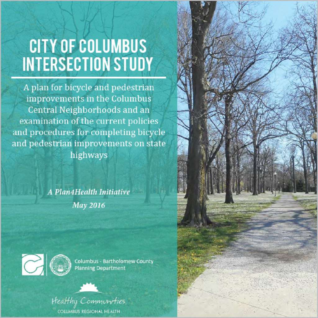
City of Columbus Intersection Study: A Plan4Health Initiative (2016)
In 2014, the Centers for Disease Control (CDC), the American Planning Association (APA), and the American Public Health Association (APHA) initiated a nationwide effort to increase opportunities for physical activity. As a lack of physical activity is a primary indicator of chronic disease, these organizations recognized the strong link between community design and public health. Community design plays a vital role in creating opportunities for physical activity, through the incorporation of sidewalks, bicycle infrastructure, and other design elements that not only allow, but promote, movement. These partnering organizations facilitated the establishment of a grant program called the Plan4Health Initiative, which encouraged communities to form coalitions and implement strategies within the built environment that encourage active living.
The coalition team in Columbus, led by Healthy Communities and the City of Columbus-Bartholomew County Planning Department, was one of only 18 communities nationwide selected to implement a Plan4Health project. The local project included the following 3 strategies: (1) the improvement of bicycle and pedestrian infrastructure in the neighborhood between Noblitt, Donner, and Lincoln Parks, (2) a review of the policies and procedures, in partnership with the Indiana Department of Transportation (INDOT), for the design of safe and convenient bicycle and pedestrian crossings at state highway intersections, and (3) the launch of a broad public awareness campaign, called “Go Healthy, Columbus,” which emphasized the importance of designing and building our community in a way that makes an active lifestyle the easy choice.
The City of Columbus Intersection Study describes the outcome of the infrastructure-related components of the Plan4Health project, listed as Strategies 1 and 2 above. To view this document, click the photo to the right.
Other Plans
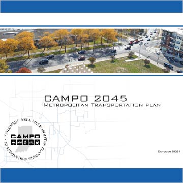
CAMPO Metropolitan Transportation Plan (2021)
The Metropolitan Transportation Plan serves as a means to forecast future transportation needs and identify a plan to meet those needs over a 25 year plan horizon. CAMPO’s 2045 Metropolitan Transportation Plan (MTP) was adopted by the CAMPO Policy Board on November 8, 2021. The MTP is updated every five years, a cycle that ensures that the document reflects ever-changing community conditions and transportation needs. To learn more about the CAMPO Metropolitan Transportation Plan, including the bicycle- and pedestrian-related improvements recommended in the document, click the photo to the right.
City of Columbus Parks and Recreation System Master Plan (2022 – 2026)
The Parks and Recreation Strategic Master Plan is a guiding document that seeks to evaluate, analyze, and strategically plan the long-term development of the City’s parks and recreation system, including the Columbus People Trail network. The Master Plan recommends expanding the People Trail to increase connectivity throughout the City. To visit the Columbus Parks and Recreation Department, where you can access the Master Plan, click the photo to the right.